- LATEST
- WEBSTORY
- TRENDING


INDIA
28 states, 9 UTs: Govt releases India’s new political map with changed status of J-K, Ladakh
The new map includes Pakistan-Occupied Kashmir (PoK) and Gilgit-Baltistan region in J-K and Ladakh, respectively.
DNA Web Team | Nov 02, 2019, 08:36 PM IST
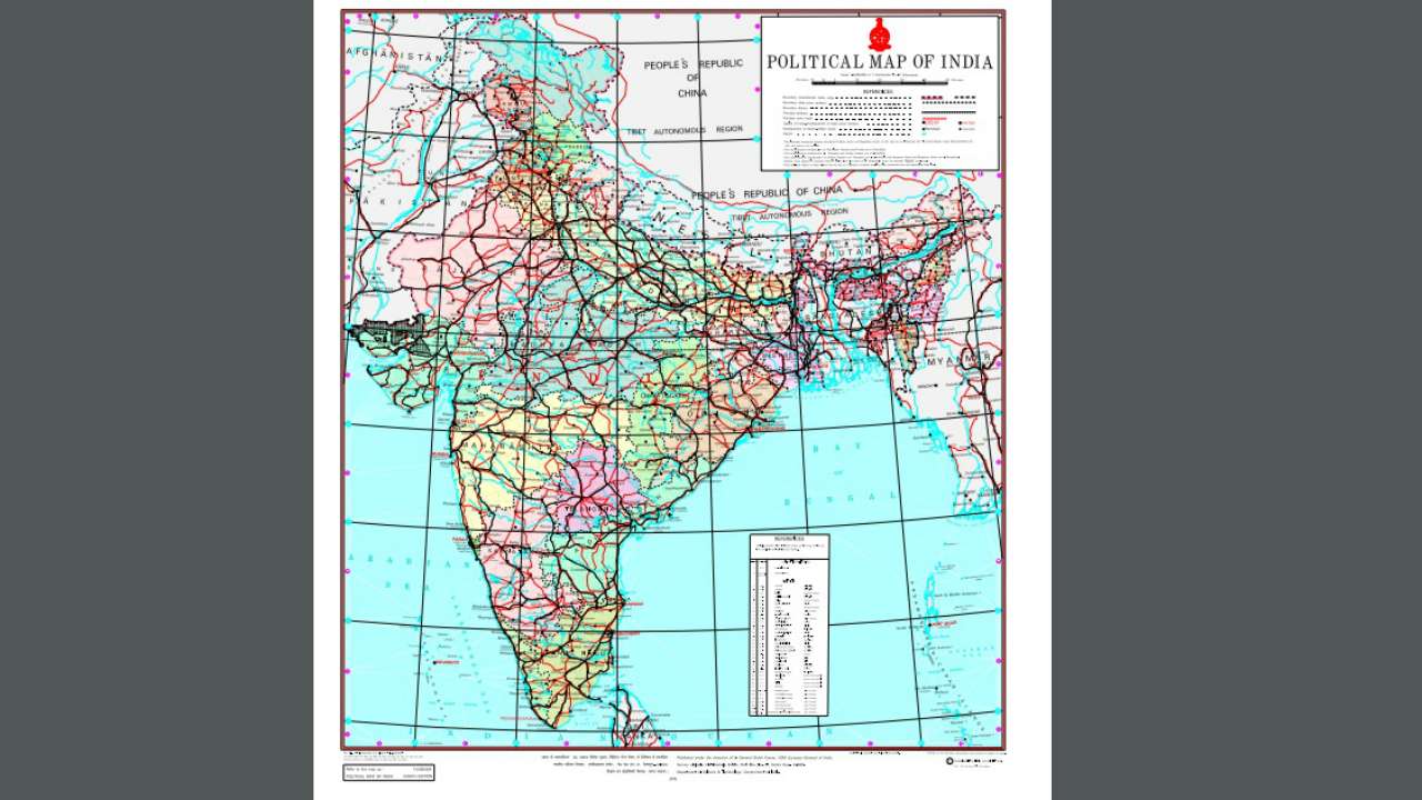
1.New India map: 28 states, 9 UTs

On the birth anniversary of Sardar Vallabhbhai Patel, marked as the National Unity Day, India's map was officially changed with 28 states and 9 Union territories.
Click here to see in high resolution the new political map of India.
2.With railway lines, major roads
The maps prepared by Survey General of India depicting the new Union Territories of Jammu & Kashmir and Ladakh.
Click here to see in high resolution the new political map of India.
3.List of districts: J-K and Ladakh
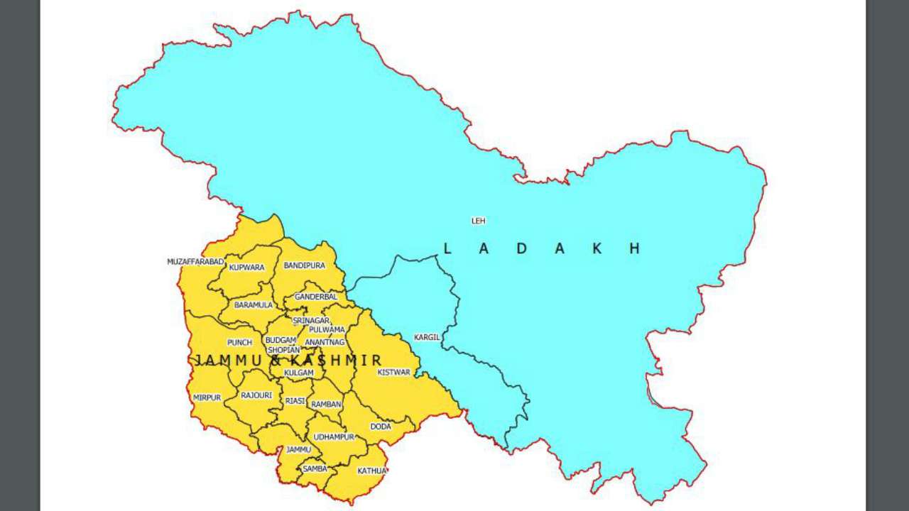
In 1947, the former State of Jammu and Kashmir had the following 14 districts - Kathua, Jammu, Udhampur, Reasi, Anantnag, Baramulla, Poonch, Mirpur, Muzaffarabad, Leh and Ladakh, Gilgit, Gilgit Wazarat, Chilhas and Tribal Territory.
By 2019, the state government of former Jammu and Kashmir had reorganized the areas of these 14 districts into 28 districts. The names of the new districts are as follows - Kupwara, Bandipur, Ganderbal, Srinagar, Budgam, Pulwama, Shupian, Kulgam, Rajouri, Ramban, Doda, Kishtivar, Samba and Kargil.
Out of these, Kargil district was carved out from the area of Leh and Ladakh district. The Leh district of the new Union Territory of Ladakh has been defined in the Jammu and Kashmir Reorganization (Removal of Difficulties) Second Order, 2019, issued by the President of India, to include the areas of the districts of Gilgit, Gilgit Wazarat, Chilhas and Tribal Territory of 1947, in addition to the remaining areas of Leh and Ladakh districts of 1947, after carving out the Kargil District.
4.J-K Map
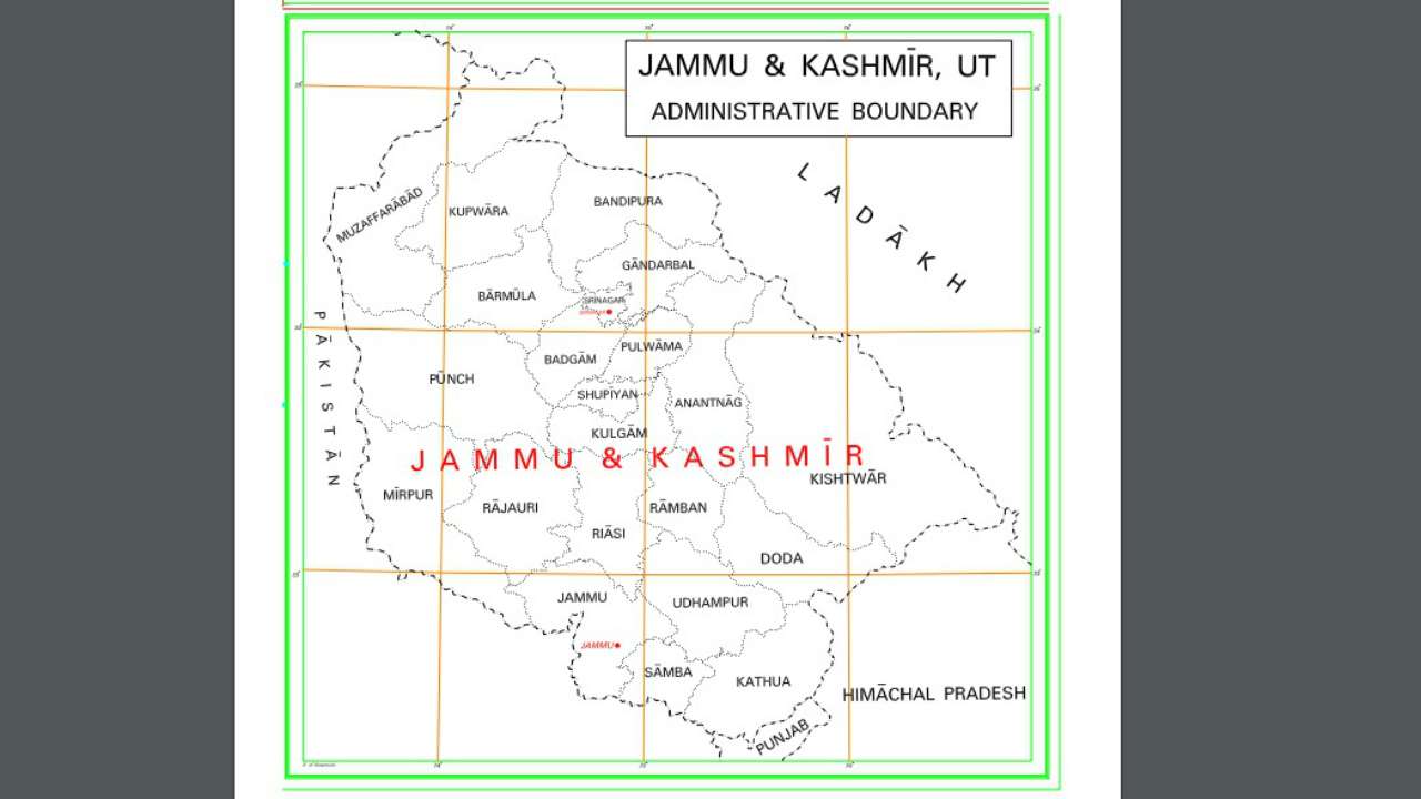
Jammu and Kashmir will have its own elected legislature and government, presided over by the appointed Lieutenant-Governor, more or less like the Delhi and Puducherry models. GC Murmu, a former bureaucrat from PM Modi’s home state of Gujarat, was sworn in as the first lieutenant governor of the union territory of Jammu and Kashmir.
TRENDING NOW
)

7 times XXX, Gandii Baat actress Aabha Paul crashed the internet by flaunting her sexy curves
)
32-year-old superstar forcibly kissed 15-year-old co-star; left her traumatised, crying; later laughed about it saying..
)
This Amitabh Bachchan flop ended popular film franchise, was based on cult classic, got affected by Baahubali 2 mania
)
Gandii Baat, XXX actress Aabha Paul sets Instagram on fire with hot photos
)
Meet Mohini Dey, India's youngest female bassist, started working with AR Rahman at 15, has also announced her divorce
)
From swanky cars to multi-crore houses: Step inside AR Rahman's ultra-lavish lifestyle with net worth of Rs 17280000000
5.Ladakh Map
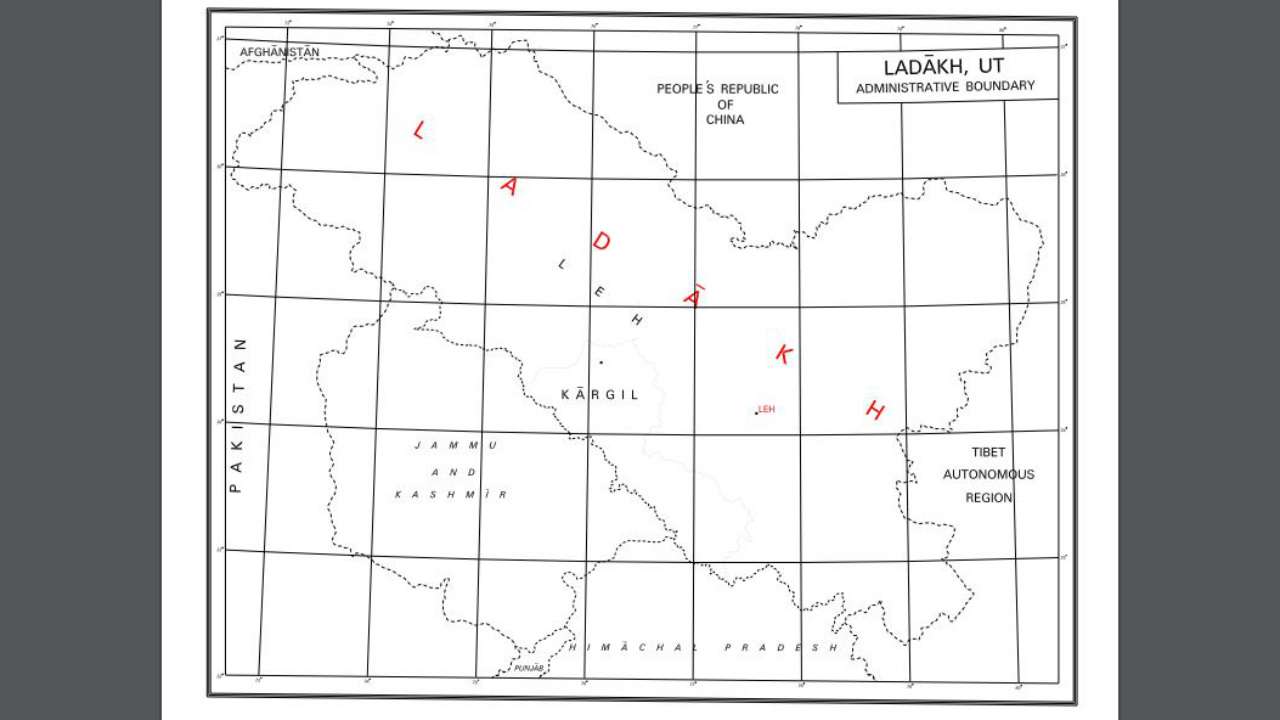
The new Union Territory of Ladakh consists of two districts of Kargil and Leh. The rest of the former State of Jammu and Kashmir is in the new Union Territory of Jammu and Kashmir.
The Union Territory of Ladakh will not have a legislative assembly and will be directly governed by the Home Ministry at the Centre via an appointed Lieutenant-Governor, like Andaman and Nicobar Islands.
A former civil servant, Radha Krishna Mathur, took oath of office as the Lieutenant-Governor of Ladakh.